

The Wealth of Poverty Point
The Wealth of Poverty Point
Louisiana based photogrammetrist Frank McMains shares how 3D technology is making the history of this UNESCO World Heritage Site available to researchers around the globe.

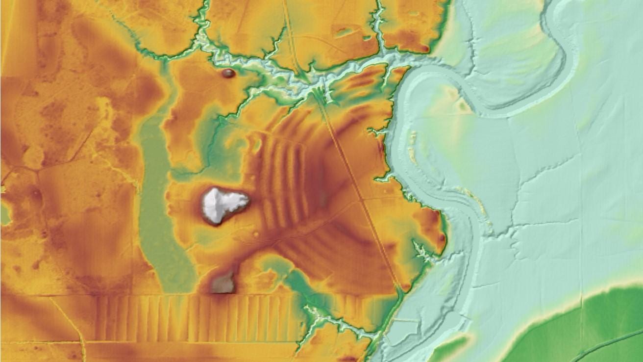
The Monumental Earthworks of Poverty Point is a UNESCO World Heritage site located in northeast Louisiana, in the southern United States. The greatest level of activity at the site occurred during the period known as the Late Archaic in North America (2000 – 500 BC). Mounds construction began by about 1650 BCE and apparently ended around 1250 BC. The people who built the earthworks were hunter-fisher-gatherers living in a rich and productive environment. Relying only on the available wild resources, people were able to move monumental quantities of earth almost 2000 years before maize became a staple food in the Mississippi River Valley. (Agriculture is sometimes considered to be a prerequisite of “complex” civilization and monumental architecture.) The site acted as a residence for the community, a ceremonial center, and a place for exchange, but the specifics of why certain mounds and earthworks were constructed is not yet clear or agreed upon by archaeologists.
My name is Frank McMains. I make 3D models using photogrammetry. Recently, I have been working with archaeologists and staff at the Poverty Point World Heritage Site (WHS) to create high-resolution models of some of the extraordinary artifacts made by the people of the Poverty Point culture. I was introduced to 3D modeling by way of photography, drones, and GIS. Much of my 3D modeling experience comes from numismatics and you can find almost 150 detailed coin models in this Sketchfab collection.

The goal of my project at the Poverty Point WHS is to document items so that the resulting models can be used by a wider body of academics and researchers. Poverty Point is a remote site and many of the items from the site, and the broader Poverty Point culture, are dispersed across museums, universities, and private collections. Modelling artifacts from these collections allows more researchers to examine the material and bring their breadth of knowledge to bear on these enigmatic objects. 3D models of the artifacts also allow interested parties to examine the corpus of artifacts as a whole rather than items in geographically dispersed collections.
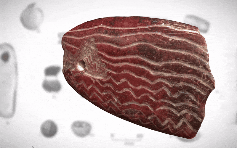
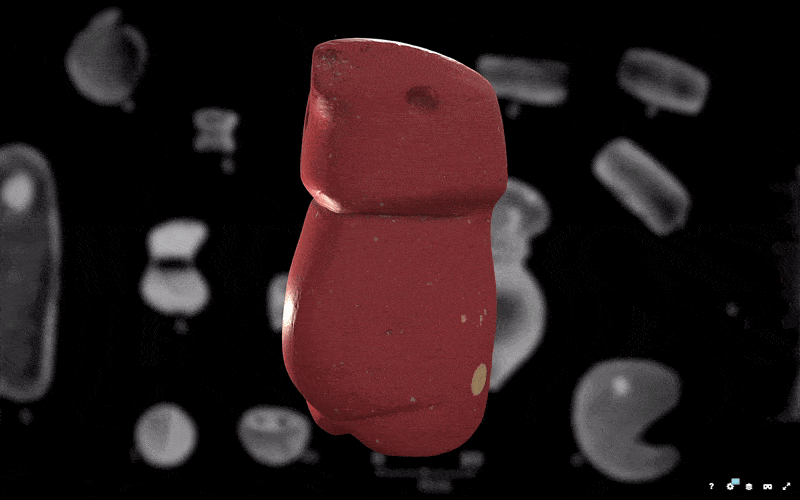
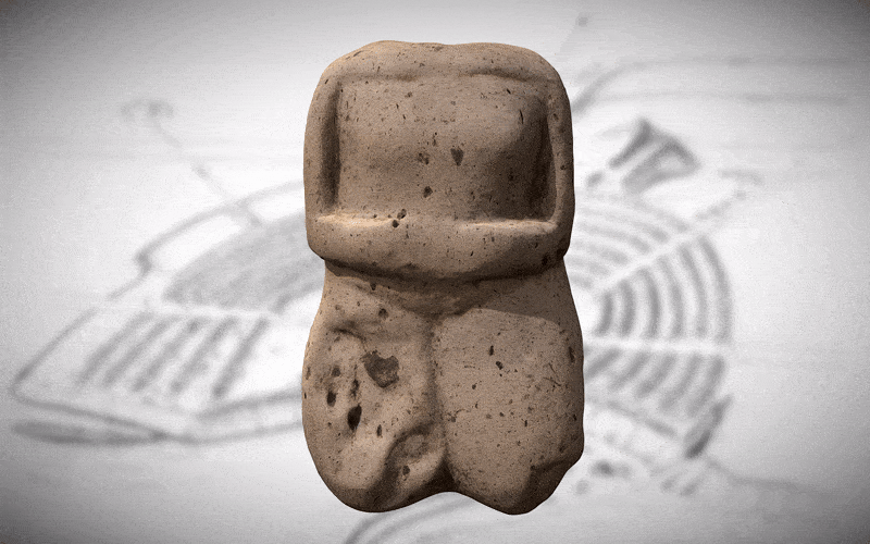
The project documents the enigmatic items called gorgets, stone plaques with holes drilled in them and exhibiting perplexing use-wear. My colleague on the gorget portion of the project is currently writing up her conclusions as to the use of the gorgets. The inhabitants of Poverty Point also made effigy beads from local alluvial gravels, mainly depicting the burrowing owl (Athene cunicularia)— these are the subject of the second portion of the project. Lastly, I am documenting baked-earth human figurines. There are about 150 figurines in the site collection, and the goal is to document the figurines to begin developing a typology of them.
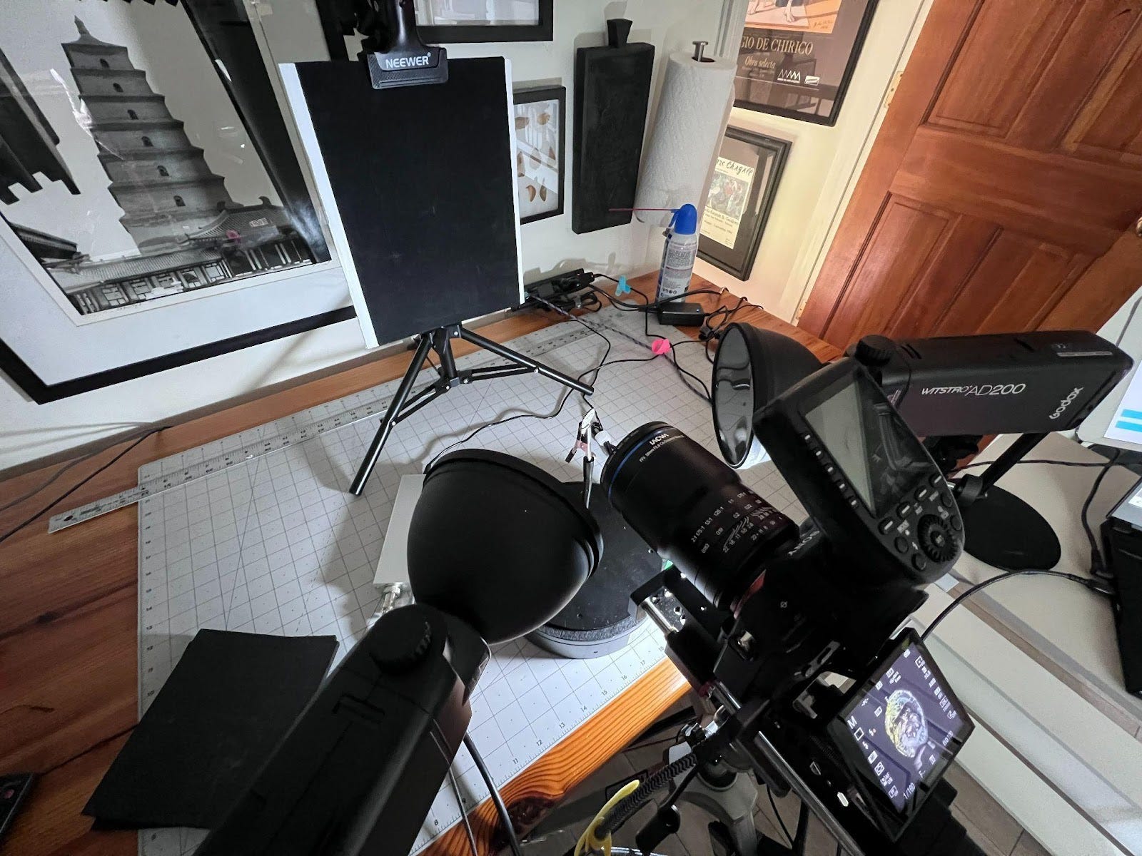
These models were created with a Sony a7iii camera and Laowa macro lenses, either the 58mm f/2.8 X2 Macro or the 85mm f/5.6 X2 Macro. The subjects are photographed on an electronic turntable, to which they are affixed with mounting putty, sometimes on an elevated stand. Two Godox AD200s with linear polarizing film over reflectors provide the light, a circular polarizing filter is used on the macro lens, thus cross-polarizing the light. A WeMacro focusing rail was used to capture the photos that were then focus-stacked in HeliconFocus, edited in Adobe Lightroom and assembled into 3D models in Metashape. You can see a brief explanation of methodology here.
Cultural heritage preservation and education is one of the most compelling and productive uses for 3D modelling technology. It provides an exciting fusion of history, technology, and storytelling. Indeed, there is a lot of activity in the 3D space and many talented people are producing beautiful photogrammetry-based cultural heritage 3D models. This includes the productive, helpful, and skilled Harald Wraunek. I also appreciate Saulius Zaura’s dedication to documenting the hillforts and windmills of Estonia and Latvia. The Ministry of Culture of Peru is doing some very interesting work lately. Igor Denisov, Head of the Cabinet of Archaeology of the Faculty of History of the Sterlitamak Branch of the Ufa University of Science and Technology, does wonderful fieldwork and composite modelling, and he is opening a special window on the archaeology of Eurasia that is totally engrossing. Thanks to Thomas Flynn for asking me to write a guest post for the Spatial Heritage Review, and for organizing this really helpful newsletter!
Learn more about Poverty Point from a recent article in Antiquity.
 | A guest post by
|
Fascinating man. I'd been watching your work pop up but didn't know the full story. Great work.